Case Study — Finger Lakes Daily News
Live Before You Reach Your Desk
An automated storm desk that reads the National Weather Service feed every 60 seconds and publishes branded, self-updating alert coverage—the watch hours before the warning, the warning before the broadcast cycle catches up. No staff. No paid data. None of it existed a few months ago.
The Moment
It’s Already Up by the Time You Walk Over
The tell that this actually works isn’t a dashboard. It’s what happens in the office when the sky turns.
“I hear the weather alert tone go off in the office—and by the time I get to my computer, the alert is already live on the site.”
Scott Swanson · Owner, FLX Local Media
No one wrote it. No one was on shift. A background service caught the National Weather Service alert off the wire, wrote a branded, plain-English story, drew the map, and pushed it live—in the seconds it took to cross the room. When the storm changes, the same story updates itself. When it’s over, it marks itself lifted.
How It Works
The Same Official Feed—Just Faster to Our Audience
We don’t front-run the National Weather Service or replace anyone’s emergency alerting. We read the same public NWS alert feed that EAS and NOAA Weather Radio pull from—and surface it on our own site the instant it changes, before it has finished cycling onto the airwaves.
The Receipt — June 14, 2026
The Threat Was on Our Site 3 Hours Before the Warning
A real severe-weather afternoon, reconstructed from the timestamps on our own live page. The Severe Thunderstorm Watch posted at 2:46 p.m. The Warning that follows on the airwaves didn’t come until 5:53 p.m.—3 hours and 7 minutes later. Our readers had the head start the whole time.
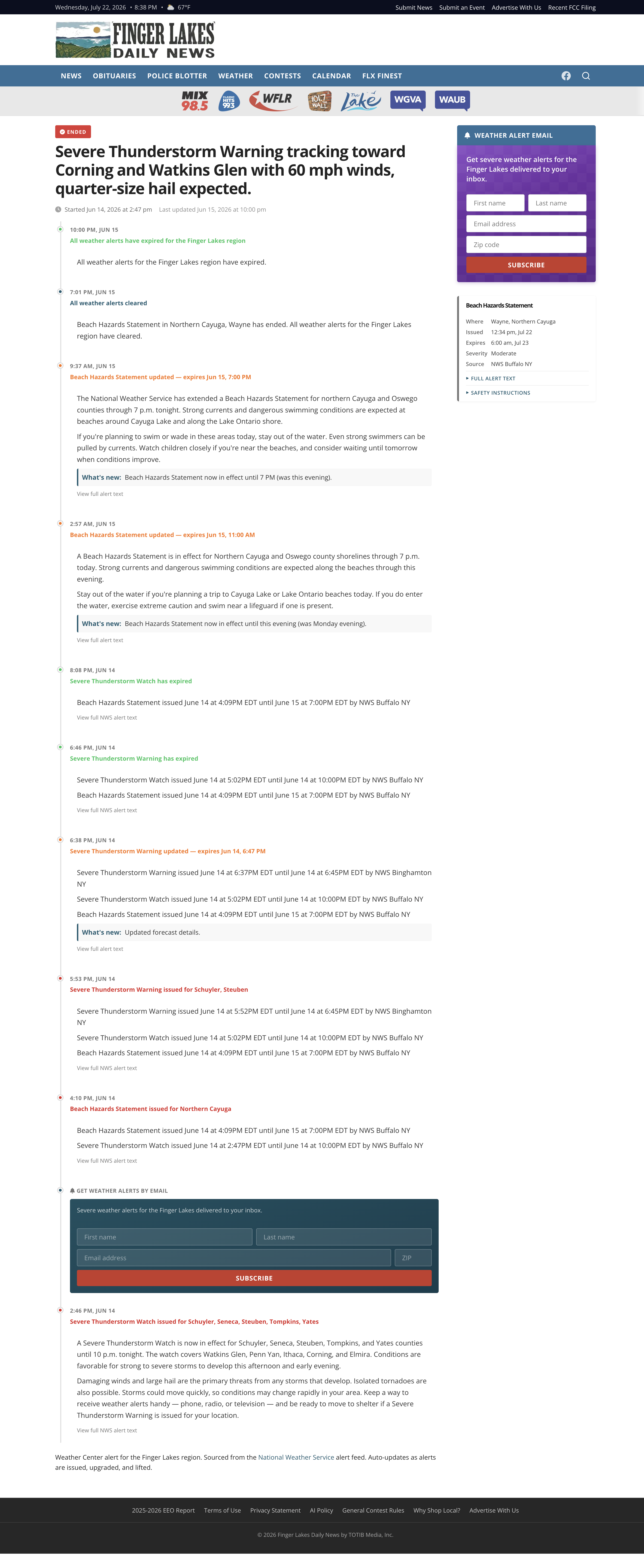
As it appeared on fingerlakesdailynews.com — every entry stamped with the NWS issuance time. Scroll to see the full self-updating timeline.
The Receipt — July 21, 2026
One Story That Writes, Extends, and Retires Itself
A single storm, one live page, four automatic updates—issued at 12:32 p.m., extended at 1:10, cleared at 2:16, expired at 5:16—then closed out with related coverage. The footer says it plainly: “Sourced from the National Weather Service alert feed. Auto-updates as alerts are issued, upgraded, and lifted.”
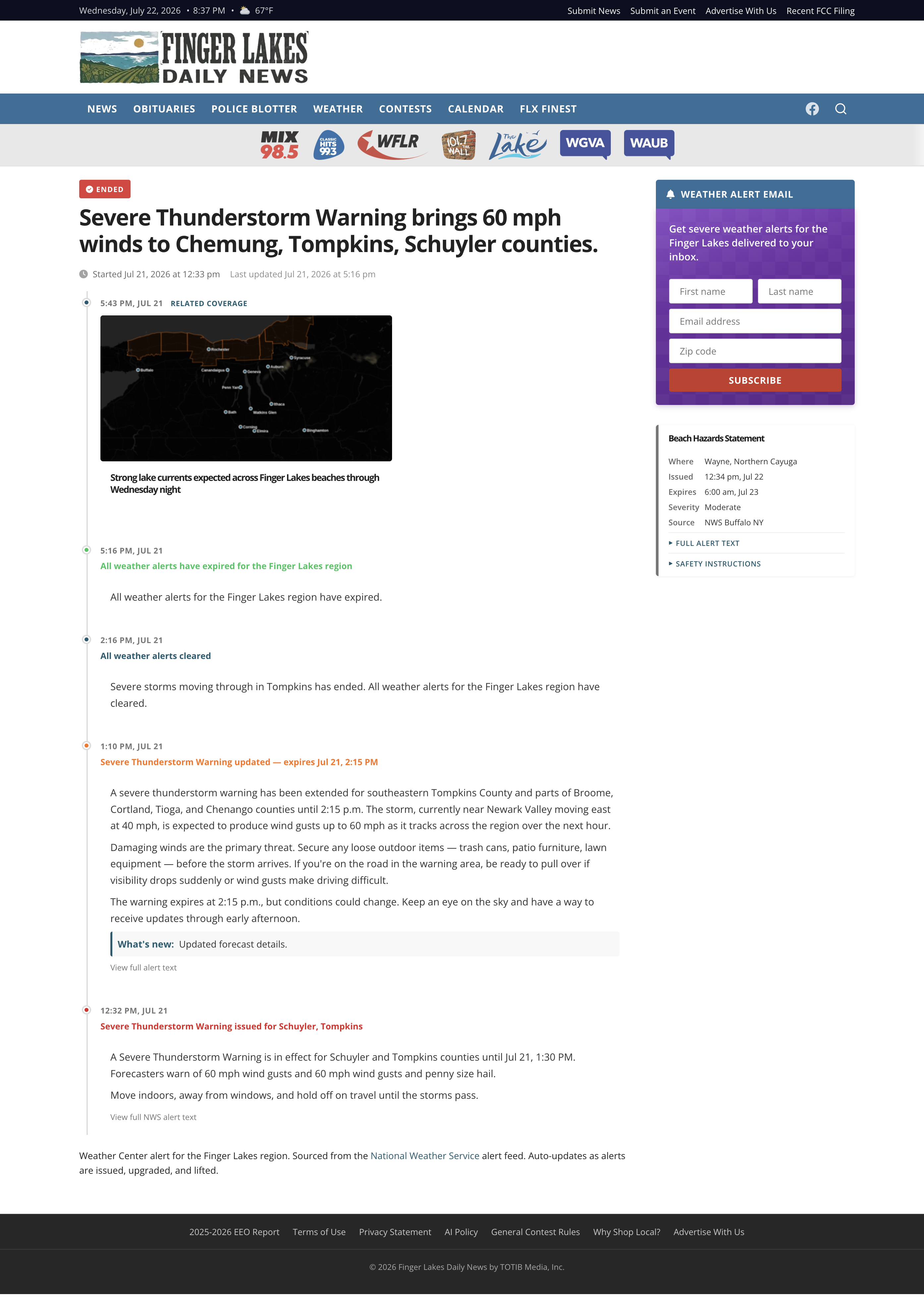
Note the sidebar: a live Beach Hazards Statement (issued that day) and a “Weather Alert Email” signup—the audience surface a sponsor attaches to.
Not a Demo — It’s On Right Now
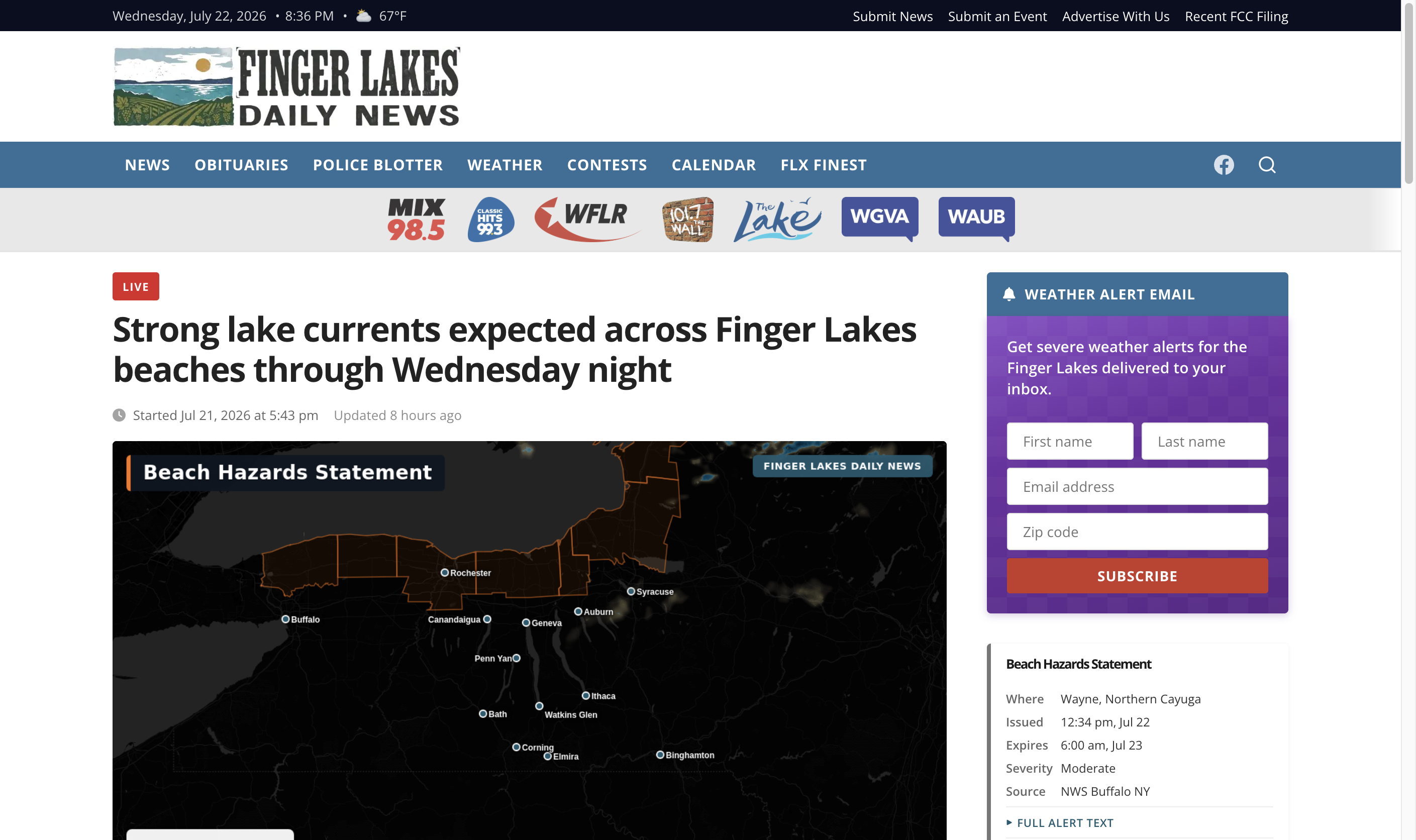
Every Alert, Automatically, Every Day
This isn’t a highlight reel of two storms. The alert desk runs continuously—severe thunderstorms, floods, winter storms, heat and air-quality advisories, beach hazards. Here it is handling a live NWS Beach Hazards Statement, captured straight off the site.
The Curve — Google Search Console
From 3,568 to 457,933 — in Six Months
In January the weather section had almost no search footprint, because it didn’t exist. As the alert desk and forecast pages came online this spring, the reach compounded: monthly Google impressions for the weather pages grew 128× from January to June 2026. Visits (clicks) follow the storms—every severe-weather event is a spike.
Source: Google Search Console — fingerlakesdailynews.com weather pages. The section did not exist before 2026.
The Payoff — Share of Voice
When a Storm Hits, We Own the Results Page
Speed isn’t just a nice story—it’s search dominance in the exact moment demand spikes. Because our alert pages publish and get indexed during the event, not after, they land at the top of Google when the whole region is searching. On a live “Flood Warning for Finger Lakes Region” query, Finger Lakes Daily News is the #1 organic result and every single Top Story.
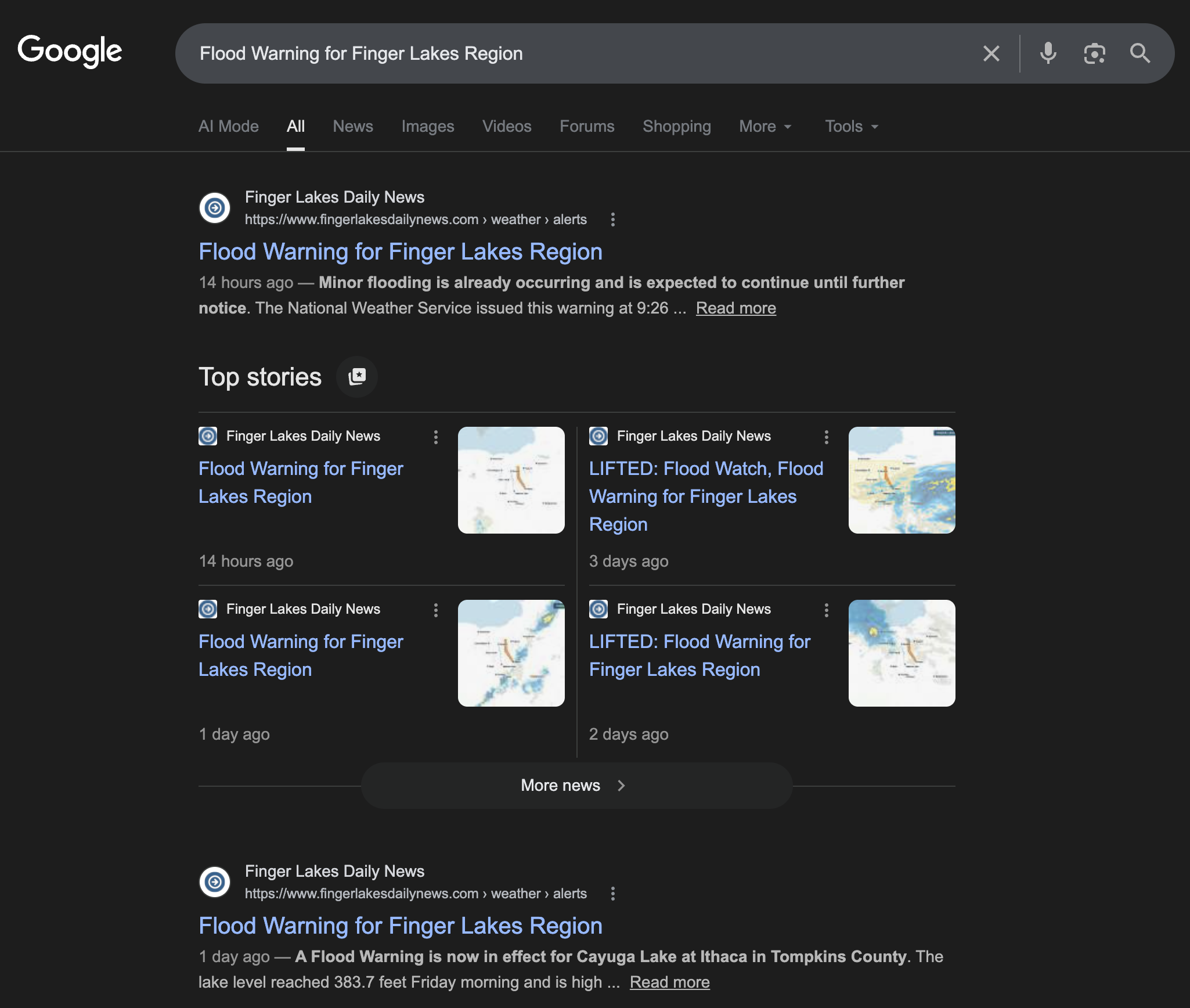
(from 259,056 impressions)
Why It Matters
Weather Is the Moment Local Media Is For
Severe weather is the single biggest reason people turn to a local station’s website and social—and it’s exactly when a lean newsroom is slammed or off the clock. Turning the free government alert feed into instant, on-brand, self-updating coverage means you own the storm story instead of losing that audience to TV or weather.com. We built the whole thing from a standing start in a few months this year—proof it’s a realistic play, not a moonshot.
Free input, owned audience
The NWS alert feed is public and license-free. The cost isn’t data or talent—it’s the plumbing that turns a warning into a branded post the instant it’s issued, and takes it down the instant it clears.
A sponsorable franchise
Always-on weather coverage—alerts, the live-blog, the email signup beside it—is a natural “Weather brought to you by ___” package. Automated public service that funds itself, not a cost center.